By Olivier Walther, University of Florida
This atlas explores the geography of Mali, from Aguelhok to Kayes and from Taoudenni to Sikasso, through the 1:200,000 maps produced by the French National Geographic Institute (IGN) in the 1950s and 1960s. Each map serves as a starting point for a reflection on the nature of geographical space. Taken together, these commentaries show the variety of the Sahara and of the Sahel and the many ways in which societies have contributed to shaping these extraordinary regions.
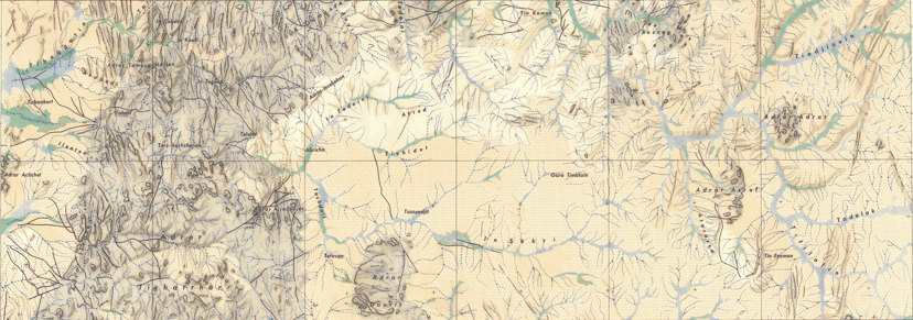
Four main regions
To facilitate access to the maps, Mali has been divided into four main regions:
- The North includes Taoudenni and Araouane.
- The Adrar des Ifoghas and Ménaka region includes Gao and Kidal.
- The Inner Niger Delta and Gourma region includes Timbuktu, the Dogon Country, and Mopti.
- The West includes Kayes and Bamako.
Click on the links above to go directly to the maps of the region.

More than 60 years after they were first drawn, the IGN maps are still the most detailed ever produced in the region. Mali was divided by the IGN into 134 sheets covering one degree of latitude and one degree of longitude, which corresponds to roughly 10,000 square km. Some sheets have been adjusted to the peculiar shape of the Malian state. Five maps of southern and eastern Mali have not been digitized, resulting in 129 maps. Some of the IGN maps are discussed together, because they split a large city-region or are mostly “empty”.
A subjective bibliography
This very personal atlas builds on my own travels and research in Mali. It is also informed by a selection of studies which are part of my “academic genealogy“. Most of the scientific production on the geography of the region was produced by European geographers, since Barth‘s Travels and Discoveries in North and Central Africa in 1858. Malian geographers are all too rare, both in the past and today, unfortunately.
One of my favorite source from the early twentieth century is Théodore Monod, whose studies of the Majâbat al-Koubrâ and other Saharan regions, carried out in the late 1930s, remain legendary for their scientific rigor and the audacity of their author. It is also during the colonial period that the many forms taken by the Malian desert are documented by physical geographers or colonial officers, such as Lt Dufour.
The post-colonial period saw a renewed interest in the forms of the Malian landscape and in the mobility of its people. In physical geography, Robert Capot-Rey described the relief of the Sahara in unprecedented detail, while Pierre Rognon and his colleagues examined the past of the Niger River and its enigmatic bend. At the same time, human geographers documented the relationships linking Sahelian and Saharan societies to their cities and territories. In the Inner Delta, Jean Gallais showed for example how political power enabled several social groups to cohabit without resorting to violence.
More recent geomorphological studies by Alain Morel, Jasper Knight and colleagues have highlighted the complexity of landscape forms and the impact of climate change. In human geography, most studies dedicated to Mali tend to focus on security issues since the outbreak of the civil war in the early 2010s. Tor Benjaminsen and Boubacar Ba, for example, have turned to political ecology to explain why jihadism spreads so fast in the region, while Denis Retaillé and his colleagues have demonstrated how war contributes to shape places and flows, using the concept of mobile space.
Acknowledgments
The inspiration for this atlas comes from my parents, who took us to Bamako, Mopti and Timbuktu before it was too late; from Théodore Monod, whom I met one chilly day in his cluttered office in the Jardin des Plantes; from my wife, with whom I lived in the Bandiagara Cliff; and from Denis Retaillé, who holds the keys to the desert. I would also like to thank Leonardo Villalón, Baba Adou, Suzie Israel, Jen Nelles, and Steph Lucas for their assistance. All errors are mine and should be communicated to the author (owalther@ufl.edu). Thanks!
How to cite
Walther, O. (2024). An Atlas of Mali. University of Florida, African Networks Lab, https://anl.geog.ufl.edu/mali/.