Spatial conflict life cycle
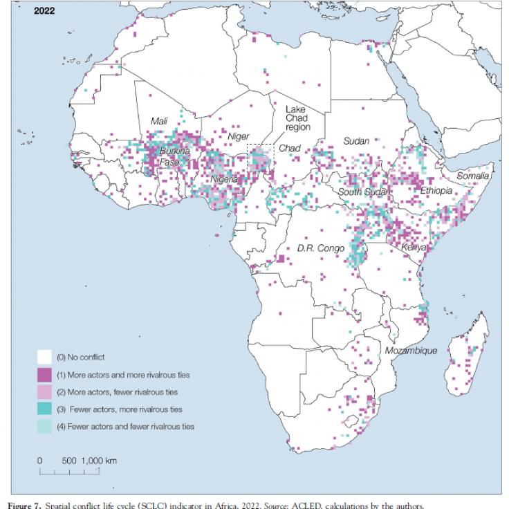 Our Lab has developed the concept of spatial conflict life cycle (SCLC) to understand regularities in the way violence is spatially and temporally distributed. Our work suggests that conflicts follow a certain number of temporal stages in their geography that resemble a cycle, from the moment they emerge in specific regions, until they end. We published the results in the Annals of the AAG in 2025.
Conflict diffusion in Africa
 We are currently modeling the spread of armed conflict in North and West Africa, with a particular focus on how violence spreads across national borders, from the Sahel to the Gulf of Guinea in West Africa. This work is part of a decade-long collaboration with the OECD Sahel and West Africa Club.
An Atlas of Mali
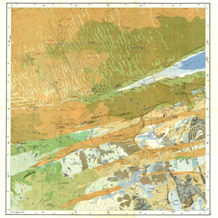 This atlas explore the complex geography of Mali through 122 maps produced by the French National Geographic Institute (IGN) in the 1950s and 1960s. The atlas shows the variety of the Sahara and of the Sahel and the many ways in which societies have contributed to shaping these extraordinary regions.
Violence in North and West Africa
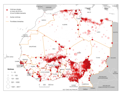
Our most recent research project examines the intensity and concentration of violent events across North and West Africa. We have developed a spatial indicator of political violence that highlights which regions experience the highest rate of conflict, how these conflicts change geographically over time, and how foreign interventions affect their geography.
Our first report was launched at the Munich Security Conference in 2020. Watch Dr. Walther’s presentation of the report on YouTube (30 min) or this short video in English or French (7 min), or read this paper. Our second report maps the evolution of conflict networks in the region since 1997. It was launched at the Sahel Coalition in March and at the UF Sahel Research Group in May 2021. Download a summary of our talks here.
More recently, we have published about the importance of borders, cities and roads for the evolution of armed conflicts in the region.
- Modeling the Spread of Armed Conflict in North and West Africa (2025-26). Funded by the OECD.
- Monitoring the Spatial Evolution of Conflicts in North and West Africa II (2023-24). Funded by the OECD.
- Monitoring the Spatial Evolution of Conflicts in North and West Africa (2021-22). Funded by the OECD.
- Foreign Interventions and Transnational Insurgencies in the Sahara-Sahel (2019-20). Funded by the OECD.
Space and political violence

Our research explores the complex relationships that bind states, transnational rebels and extremist organizations, and borders on the African continent. Combining network science with geographical analysis, we highlight how the fluid alliances and conflicts between rebels, violent extremist organizations and states shape in large measure regional patterns of violence in Africa.
-
- Transnational Extremist Organizations Networks (2016-17). Funded by Danish Agency for Science and Technology.
- Atlas of the Sahara-Sahel (2013-14). Funded by the OECD.
Women and trade networks
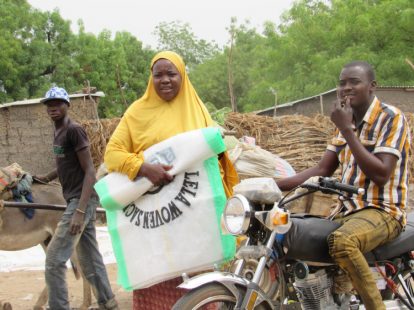
Our work highlights the crucial contribution of West African women to the region’s food and trade economy. It shows that these activities face many socio-economic and institutional barriers that limit women’s participation in trade. The analysis of these gender inequalities is based on a relational approach that makes it possible to map the actual relations maintained between economic and political actors within their social networks.
- Women and Trade Networks in West Africa (2017-18). Funded by the OECD.
- Empowering Women in West African Markets (2017). Funded by the World Food Program.
Trade, cities and regional integration

Our research provides a systematic analysis of the role border cities play in the process of regional integration in West Africa. We have developed several indicators that shed light on urban growth, the effect of distance on national cohesion and the impact territorial divisions have on trade at the international level.
- Integrating Socio-economic and Remotely Sensed Information to Characterize Conflict Precursors and Land Degradation Dynamics in Ghana (2023-25), (PI: Aditya Singh). Funded by NASA SERVIR-USAID.
- Linking deforestation, urbanization, and agricultural expansion for land-use decisions in Ghana (2020-22) (PI: Jasmeet Judge). Funded by NASA SERVIR-USAID.
- Cities and Borders (2017-18). Funded by the OECD.
- WANETS. West African Economic Networks (2013). Funded by the National Research Fund of Luxembourg.
- CROSSTRADE. Informal Trade and Cross-Border Integration in West Africa (2011-13). Funded by the National Research Fund of Luxembourg.
Cross-border policy networks
We have developed an original approach to study cross-border co-operation in West Africa. Building on a combination of statistical indicators, mental maps and social network analysis, our work has contributed to visualize the formal and informal relationships between actors involved in cross-border policy networks in the region.
- Cross-Border Cooperation and Policy Networks in West Africa (2015-16). Funded by the OECD